Quick answer
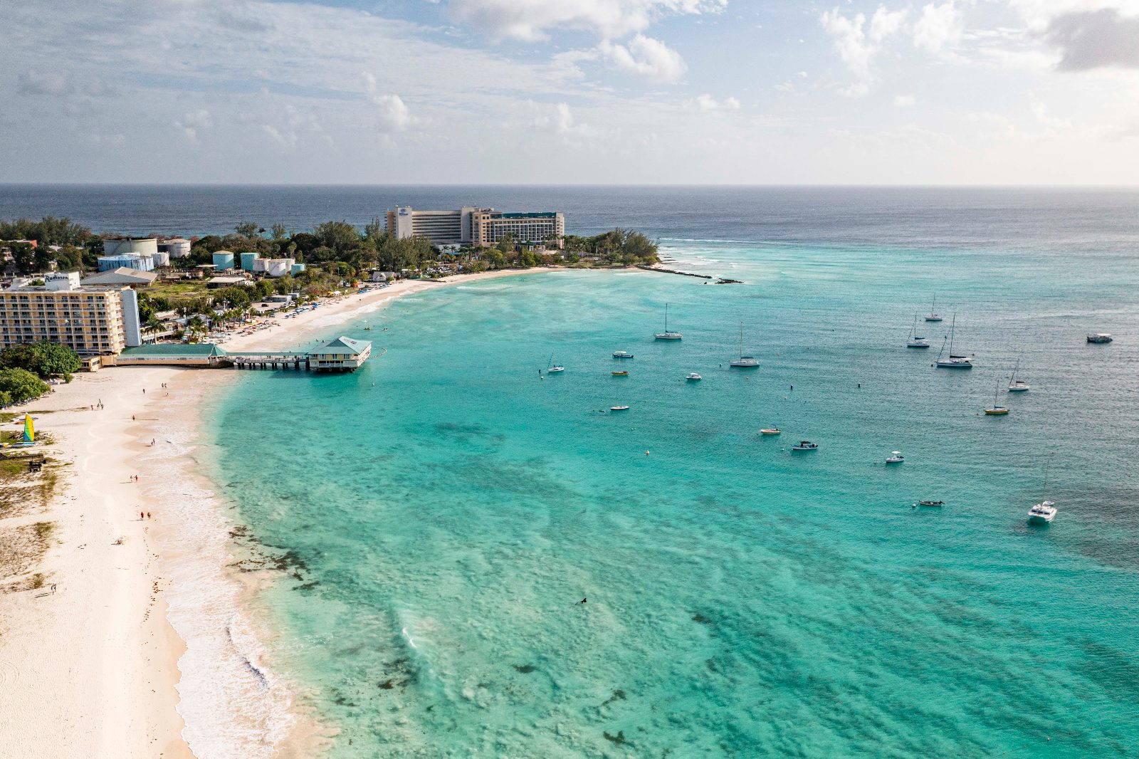
A barbados snorkeling map of Carlisle Bay charts six wreck sites spread across the bay floor between 6 and 12 meters deep, accessible from three main shore entries along the 800-meter beach. The wrecks form a rough arc 50 to 200 meters offshore: Bajan Queen and Berwyn near the southern end, Barge and Eillon centrally positioned, and Ce-Trek with Cornwallis toward the northern curve, with natural coral reefs filling the spaces between artificial structures.
Carlisle Bay functions as Barbados's most concentrated artificial reef system, with wreck positions forming a navigable underwater trail rather than a scattered debris field. The National Conservation Commission sank the vessels between 1996 and 2003 to create structured dive sites, spacing them to prevent current-driven silt clouds from obscuring adjacent structures. Each wreck now anchors its own ecosystem while remaining visible from the others underwater, allowing snorkelers to chain multiple sites in a single session without returning to shore. The bay's topography slopes gradually from a shallow sandy shelf to the wreck zone, with depth increasing roughly one meter for every 15 meters traveled offshore. This gradient places the shallowest wrecks within easy surface swimming distance for moderately confident snorkelers, while deeper structures require stronger swimming stamina or flotation aids. Shore entries cluster near Boatyard Beach Club, the public beach mid-section, and Copacabana Beach Bar, each providing direct access to different wreck groupings without requiring boat transport. Underwater navigation relies on the wrecks themselves as reference points rather than compass bearings, since Carlisle Bay's protected curve limits strong currents that might disorient swimmers. The Bajan Queen serves as the southernmost landmark, its hull sitting upright and intact at 12 meters, while the flattened remains of the Barge mark the bay's center. Reef formations grow densest between the Ce-Trek and the Eillon, where snorkelers report frequent green sea turtle sightings along the sandy channels connecting the two hulls. Water clarity averages 15 to 20 meters on calm mornings, allowing simultaneous visual contact with multiple wrecks from a central snorkeling position, but午後 boat traffic and wave action reduce visibility to under 10 meters by midday. A barbados snorkeling map gains practical value when cross-referenced with tidal patterns and your own swimming range—most first-time snorkelers successfully reach the Barge and Eillon without assistance, while the Cornwallis and Bajan Queen demand stronger finning endurance or a guided surface float. Local operators offer laminated underwater slate maps for rent, marking wreck positions with GPS coordinates converted to visual landmarks like the pink hotel or the pier pilings visible from the water.
“Carlisle Bay's wreck positions form a navigable underwater trail rather than a scattered debris field, with each structure visible from the others below the surface.”
Optimal Timing for Your Barbados Snorkeling Map Exploration
The best arrival window for snorkeling in Carlisle Bay is 07:00–09:00. Arriving during this period ensures the highest water clarity and allows you to explore the underwater sites before mid-morning crowd surges.
Weekday mornings
Minimal—
Waters are calmest, offering optimal visibility for mapping the shipwrecks before tour boats arrive.
December to April
High24°C–29°C
Peak tourism season brings stable weather but requires early starts to avoid beach crowds.
May to November
Moderate25°C–31°C
Though historically the hurricane season, snorkeling conditions remain favorable during early morning hours.
Verdict: For the best experience, aim for a weekday arrival between 07:00–09:00 during the shoulder months of April or November.
Daily Hours for Visiting the Carlisle Bay Barbados Snorkeling Map
Carlisle Bay is a public beach accessible to visitors at all times throughout the week. The area remains open daily, allowing for flexible access to the coastline.
| Monday | 00:00–23:59 | |
|---|---|---|
| Tuesday | 00:00–23:59 | |
| Wednesday | 00:00–23:59 | |
| Thursday | 00:00–23:59 | |
| Friday | 00:00–23:59 | |
| Saturday | 00:00–23:59 | |
| Sunday | 00:00–23:59 |
Entrance Fees and Costs for Your Barbados Snorkeling Map Visit
Access to Carlisle Bay is free of charge for all visitors. Costs for your visit depend entirely on your choice to utilize optional private amenities, such as beach chair rentals or private tour services.
A typical visitor pays 0 USD for beach access, with costs only incurred if selecting optional private rental services.
Transportation and Directions to Your Barbados Snorkeling Map Site
Carlisle Bay is located in Bridgetown, Barbados, and is accessible via the main coastal roads or public transport systems. The bay is situated within walking distance of the city center, making it easily reachable by taxi or local bus routes.
Follow Highway 7 south from Bridgetown directly to the Carlisle Bay area
Take any Z-class or Transport Board bus heading south along Bay Street to the Carlisle Bay stop
Walk south from Bridgetown along the boardwalk or Bay Street toward the coastline
Request a drop-off at the Carlisle Bay beach access points from any Bridgetown taxi stand
Key Sub-Sights on the Barbados Snorkeling Map
Carlisle Bay functions as an underwater park featuring several deliberate shipwrecks and a diverse marine ecosystem. These sites are situated within a protected zone, providing consistent opportunities for observation.
Berwyn Wreck
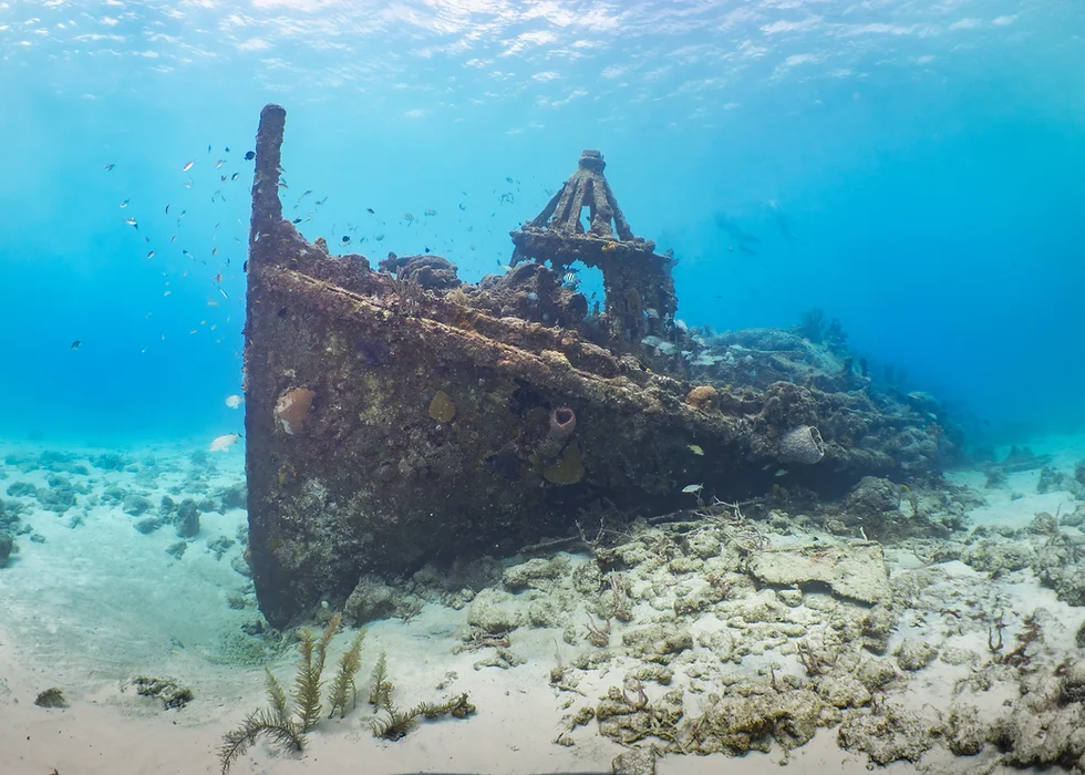
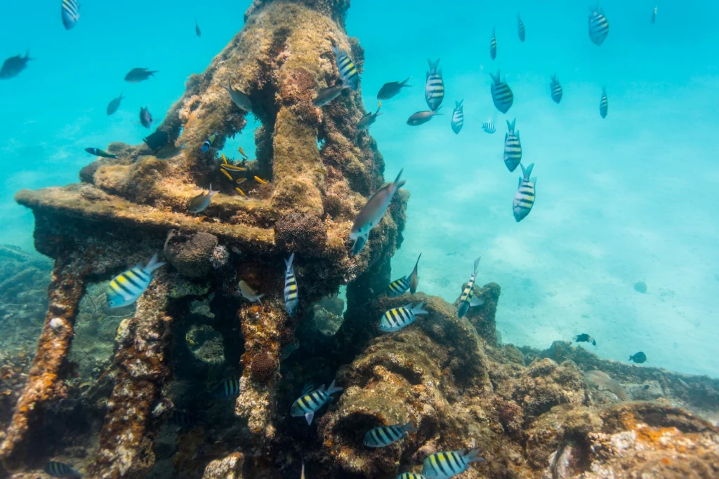
This 70-foot French tugboat sits upright in shallow water, making its bow and deck accessible to snorkelers. It is heavily encrusted with coral and frequented by schools of tropical fish.
Look for the propeller area to see dense marine life.
Eillon Wreck
A former drug-runner vessel sunk as an artificial reef, this wreck rests deeper than others but remains visible from the surface. The cargo holds often attract large sea turtles.
Swim toward the center to spot turtles inside.
C-Trek Wreck
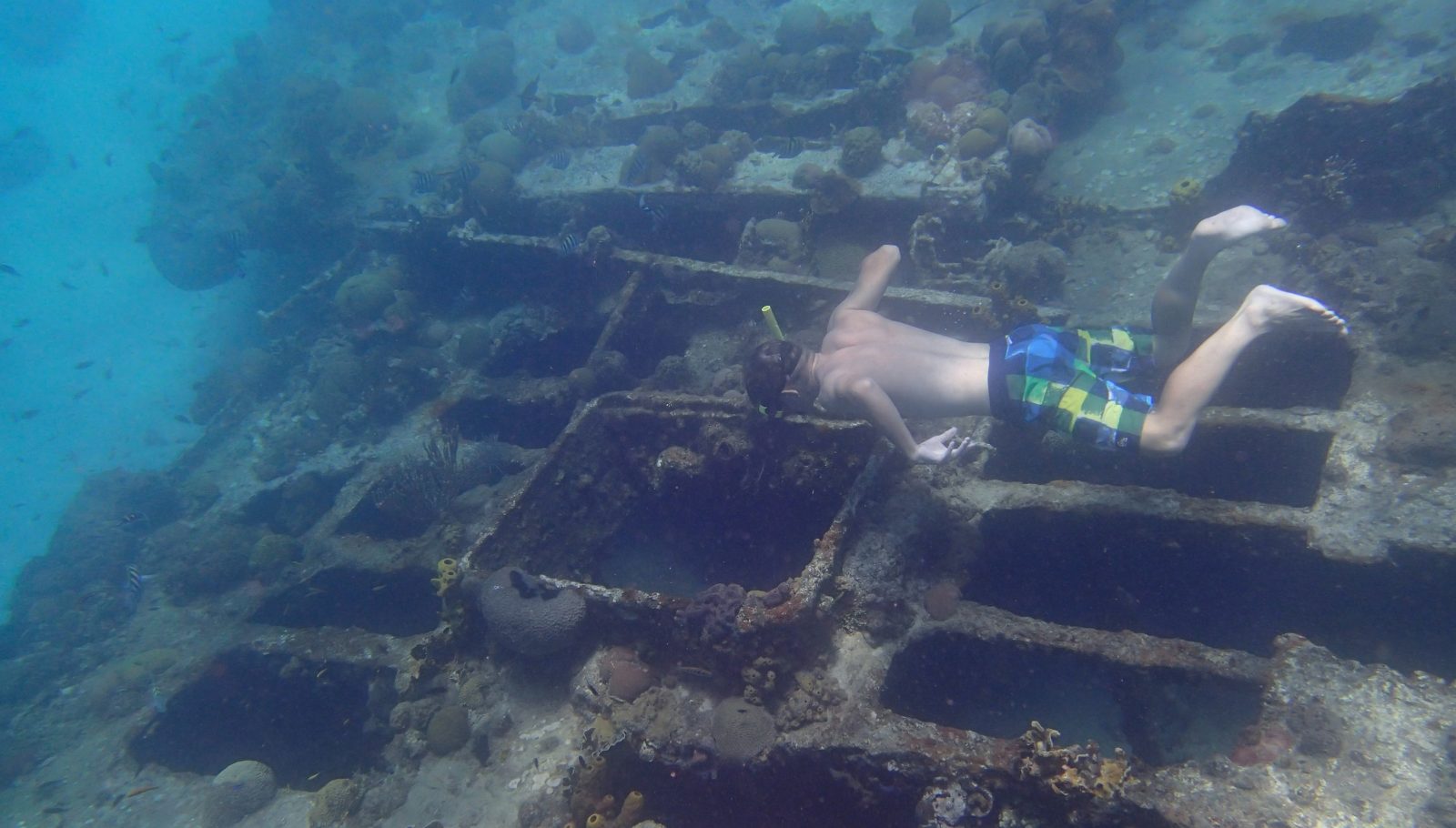
This intentionally sunk barge offers a complex structure that serves as a habitat for reef fish and stingrays. Its flat deck is positioned at a depth that allows for clear underwater photography.
Circle the perimeter to locate resting stingrays.
Marine Protected Zone
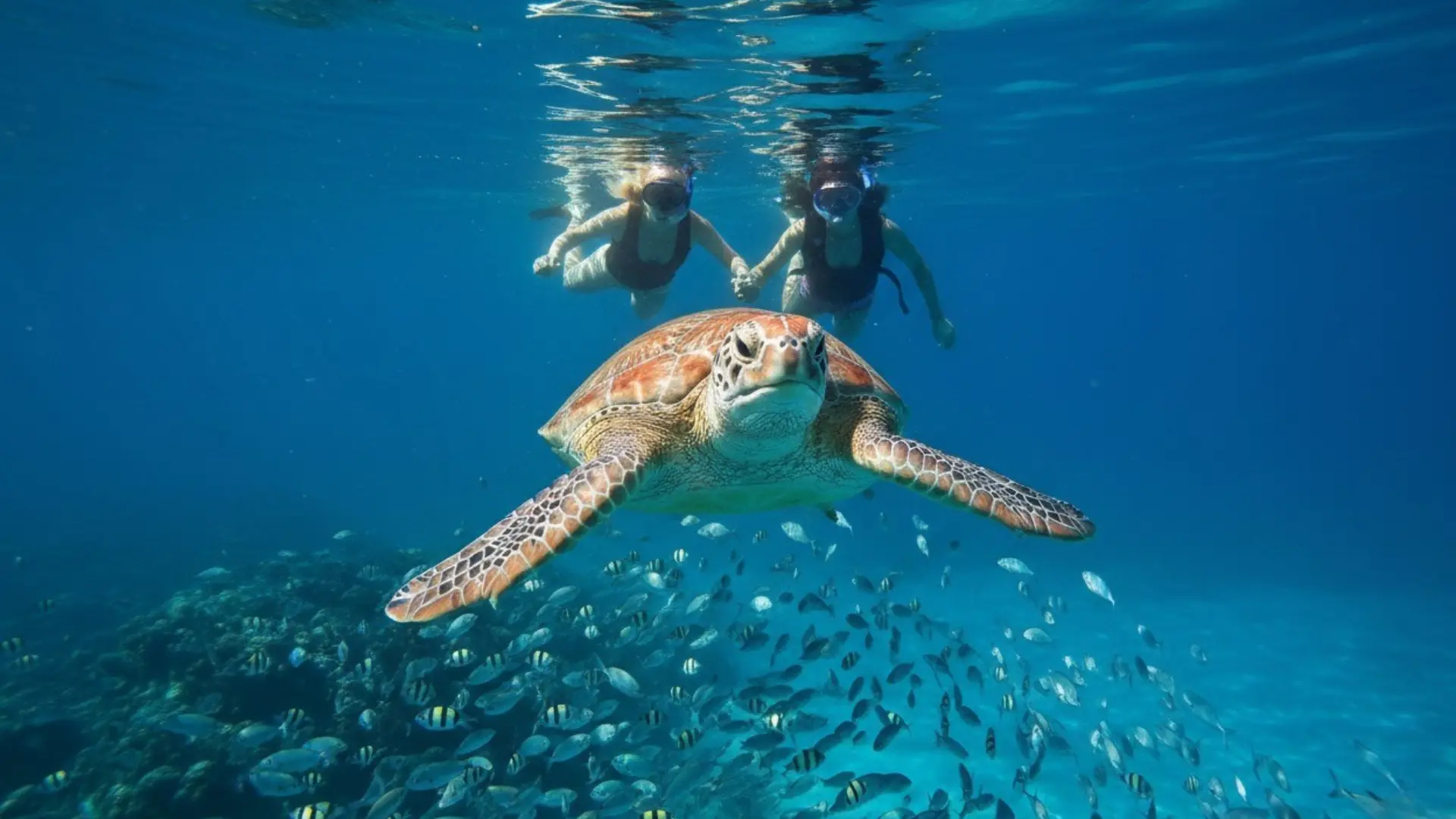
This designated area restricts fishing and anchoring, which encourages the concentration of sea turtles, rays, and diverse coral species. The sandy seafloor transition points provide clear visibility for tracking swimming turtles.
Stay near the rope lines for high turtle density.
Etiquette for Following the Barbados Snorkeling Map Safely
Carlisle Bay's wrecks and reefs host fragile corals and sea turtles that depend on visitor respect. Follow these guidelines to protect the marine ecosystem while navigating the snorkeling map.
Do
- Keep a safe distance from sea turtles and other marine life
- Stay horizontal and control your fins to avoid damaging corals
- Apply reef-safe sunscreen at least 30 minutes before entering the water
- Secure all gear and belongings to prevent debris from entering the bay
- Follow designated snorkeling routes around the shipwreck sites
- Report any injured marine life to the National Conservation Commission
Don't
- Touch, chase, or feed sea turtles or fish
- Stand on or grab corals to steady yourself
- Use sunscreen containing oxybenzone or octinoxate near the reef
- Leave trash, cigarette butts, or plastic in the water or on shore
- Swim directly over fragile coral formations or nesting areas
- Remove shells, coral fragments, or artifacts from the wrecks
Check availability
Frequently asked questions about Carlisle Bay snorkeling
Everything you need to know about barbados snorkeling map